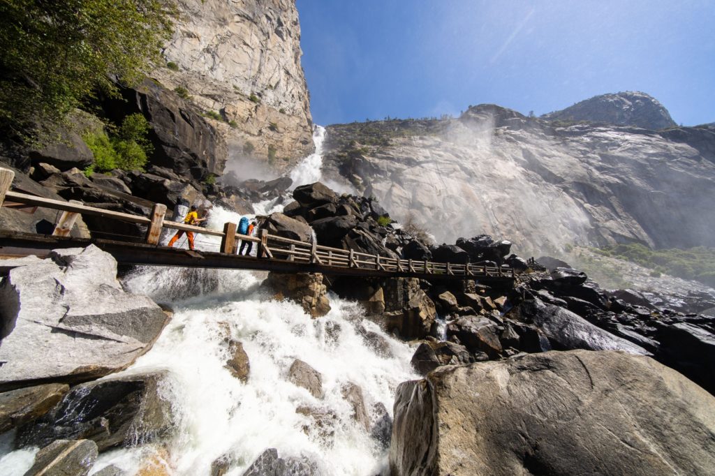
Storm flows that damaged the bridges at Wapama Falls were roughly 5 times as high as the spring snowmelt in May 2021 (shown above).
The seasonally rare “Bomb Cyclone” storm, which drenched northern California during the fourth week of October, hit Hetch Hetchy at 4 AM on October 24 and Yosemite Valley three hours later. Steady rain over thirty hours totaled 5 inches at Hetch Hetchy and 6 inches in Yosemite Valley.
Yosemite’s waterfalls, bone dry at the end of the summer in a drought year, came to life as did creeks and rivers throughout the state. Pictures of Yosemite Falls were gleefully posted all over the World Wide Web.
Photos of Wapama Falls were not available as the storm damaged the bridges at its base and the National Park Service was forced to deny visitor access to protect safety. So presently, as has too often been the case in recent years, hikers are not able to really see Wapama or to hike beyond it.
The Park Service plans to reopen the trail soon. We hope that to be true, as the rain has abated and fall has brought great hiking weather.
The Park Service has also been working on a long-term repair and relocation of the bridges at Wapama. We hope one day soon they can be open every day of the year – or only closed to the public on very rare occasions.
As we explained in Keeping Promises: Providing Public Access to Hetch Hetchy Valley, Yosemite National Park, Restore Hetch Hetchy believes the National Park Service has an obligation to provide the level of visitor access assured by the letter and spirit of the controversial Raker Act in 1913. A better bridge at Wapama is long overdue, since Hetch Hetchy Reservoir has eliminated access across the valley. We also continue to support a quiet, electric, non-polluting tour boat to show visitors the entire Hetch Hetchy canyon and transport them to trailheads along the reservoir’s shore (an idea San Francisco used to entreat Congress to allow construction of the dam and reservoir).
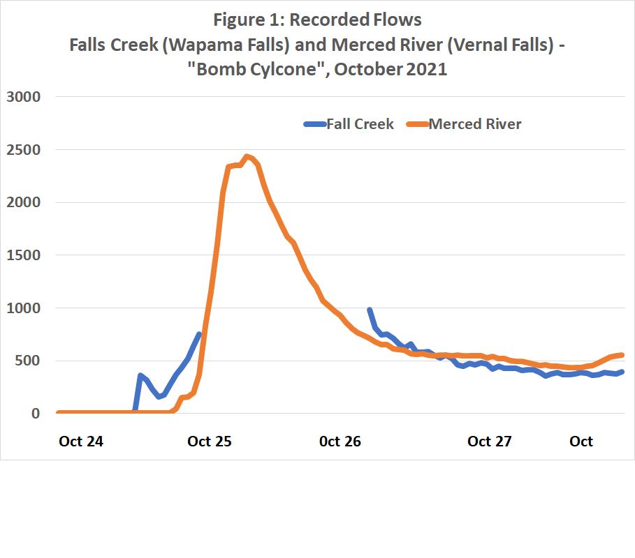
We can only guess what the peak flow of Wapama Falls was during the storm. There is an upstream flow gage, but it does not measure values over 1000 cubic feet per second. As shown in Chart 1, however, the flow gage for Wapama (aka Falls Creek) were similar to those at Happy Isles Bridge on the Merced River at the beginning and end of the storm so the peak flow may have reached a similar value – roughly five times that of the snowmelt flows last May (shown in the photo above).

